


A resource for reliable information about significant people, places, events, and things in Minnesota history.
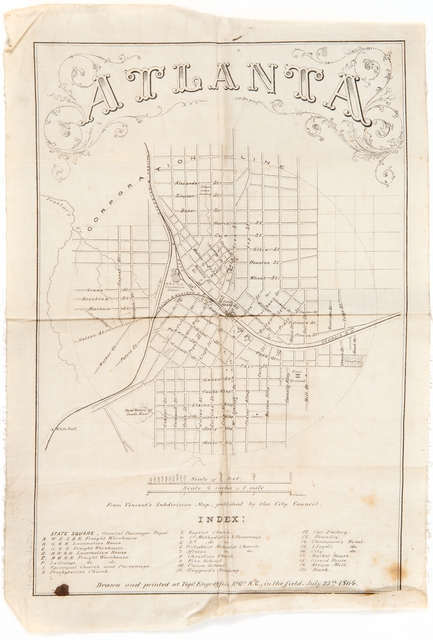
Street map of Atlanta, Georgia, printed on cotton fabric. The map includes streets, railroad lines, waterways, and an index to twenty building locations. Across the bottom is written: "Drawn and printed at Top'l. Engr. Office, Hed. Qrs. A.C., in the field, July 25th, 1864." The signature of "W.G. LeDuc" is in black ink in the upper left. The map was used during the Civil War by Brigadier General William Gates Le Duc.
Made possible by the Arts and Cultural Heritage Fund through the vote of Minnesotans on November 4, 2008. Administered by the Minnesota Historical Society.
Minnesota Historical Society • 345 W. Kellogg Blvd., St. Paul, MN 55102-1906 (Map) • 651-259-3000 © MNHS.
Send questions or comments to mnopedia![]() mnhs [dot] org. View our Privacy Policy.
mnhs [dot] org. View our Privacy Policy.