


A resource for reliable information about significant people, places, events, and things in Minnesota history.
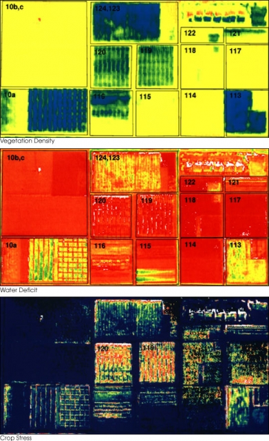
Remotely sensed image of a farm field illustrating vegetation density, water deficit, and crop stress. Photographed in 2010 by Susan Moran for the Landsat 7 Science Team and USDA Agricultural Research Service.
Made possible by the Arts and Cultural Heritage Fund through the vote of Minnesotans on November 4, 2008. Administered by the Minnesota Historical Society.
Minnesota Historical Society • 345 W. Kellogg Blvd., St. Paul, MN 55102-1906 (Map) • 651-259-3000 © MNHS.
Send questions or comments to mnopedia![]() mnhs [dot] org. View our Privacy Policy.
mnhs [dot] org. View our Privacy Policy.