A resource for reliable information about significant people, places, events, and things in Minnesota history.
Made possible by the Arts and Cultural Heritage Fund through the vote of Minnesotans on November 4, 2008. Administered by the Minnesota Historical Society.
Minnesota Historical Society • 345 W. Kellogg Blvd., St. Paul, MN 55102-1906 (Map) • 651-259-3000 © MNHS.
Send questions or comments to mnopedia![]() mnhs [dot] org. View our Privacy Policy.
mnhs [dot] org. View our Privacy Policy.
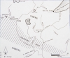
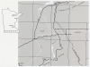
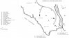
![Map of the Gunflint Trail, also known as Cook County Road 12, across northeastern Minnesota. The trail starts in Grand Marais and extends for 57 miles to Saganaga Lake. The map was created by Wikimedia Commons user Fredddie [sic] on July 28, 2015. GNU free documentation license 1.2.](https://www.mnopedia.org/sites/default/files/styles/thumbnail/public/Map_Fredddie_Wikimedia_.png?itok=4xsxxAZg)