A resource for reliable information about significant people, places, events, and things in Minnesota history.
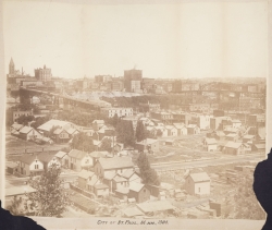
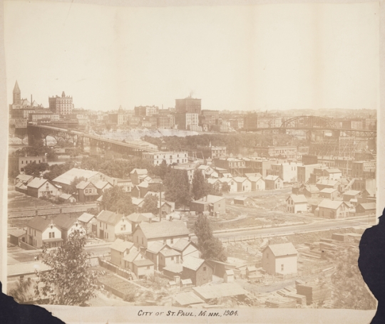
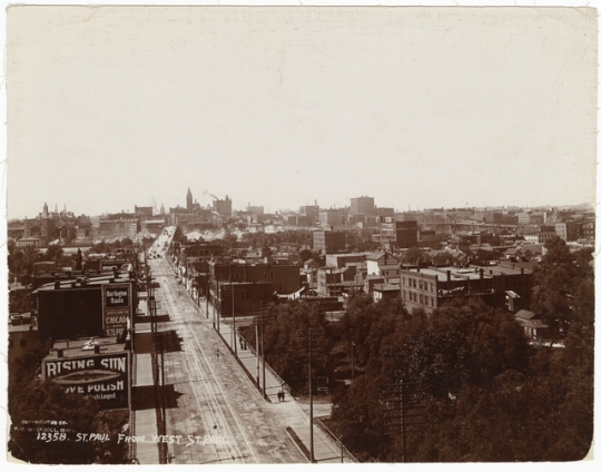
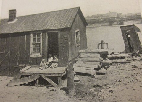
West Side Flats and Wabasha Bridge, 1904.
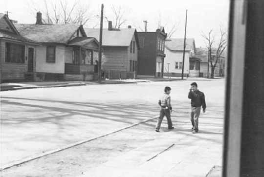
From the 1850s to the 1960s, St. Paul’s West Side Flats was a poor, immigrant neighborhood—frequently flooded but home to a diverse group of Irish, Jewish, and Mexican workers and their families. In the early 1960s all residents were moved out to make way for an industrial park.
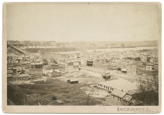
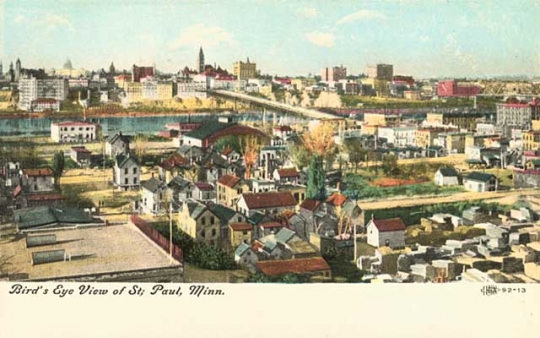
A twenty-first century visitor to St. Paul’s Riverview Industrial Park would be surprised to learn that this area was once a residential enclave. This was the West Side Flats, and for about a hundred years, from the 1850s to the 1960s, life bloomed there. A unique neighborhood in Minnesota and the wider U.S., the Flats were dense, low-income, polyglot, striving, unpaved, and unpainted.
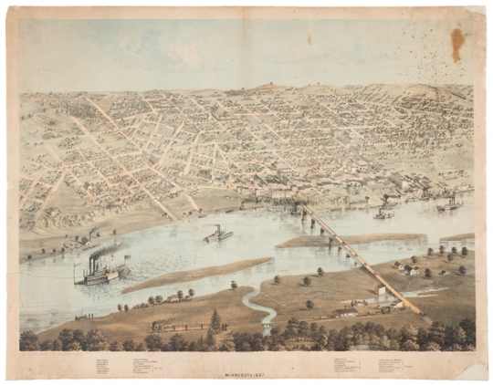
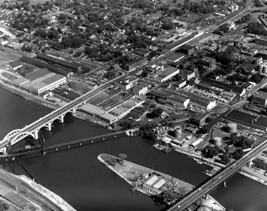
The Flats occupy the lowlands immediately south of downtown St. Paul and across the river. Where the land rises, or turns into a bluff, the Flats end and the rest of the West Side extends up and south to Annapolis Street, the border with West St. Paul. The Lafayette and High Bridges mark the east and west extensions.
The first non-Native residents of the Flats were French Canadians and Yankees. Then came Germans, more speakers of French, and refugees from multiple potato famines in Ireland, some of whom came to the Flats rather than to Connemara Patch across the river. The first bridge connecting the Flats with downtown St. Paul was completed in 1859. St. Paul annexed the West Side (then part of Dakota County) in 1874 and built a new bridge to replace the first where the Wabasha Bridge crosses today. The Robert Street and railroad bridges went up in 1886. From then on, the West Side was fully connected to the rest of the city.
Events in Russia affected the Flats as profoundly as the bridges. Just as famines in Ireland had done, pogroms and anti-Jewish laws in Russia set off mass emigration to the United States in the 1880s. The first Russian Jews reached St. Paul in winter 1882. About twenty of them made their way to the Flats later that year, and over the next few decades, hundreds more followed. By 1915 over 70 percent of the Flats’ residents were Jewish.
The Flats can be thought of as a village within the city. Made distinct by geography (river to the north, bluffs to the south) and language (Irish, Russian, Polish, Yiddish, Lithuanian), the Flats developed an internal economy based partly on family entrepreneurship. From a population that probably never exceeded two thousand, scores of businesses arose: junk dealers, egg candlers, tailors, cobblers, and butchers. A 1910 count found over a hundred such enterprises on the Flats.
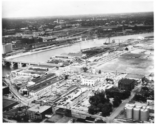
Other men worked as laborers, and the West Side usually offered plenty of work. On the Flats themselves were American Hoist and Derrick, Minnesota Macaroni, Gedney Pickles, and the Waterous Company, maker of firefighting equipment. A little south, against the bluffs, stood Yoerg Brewery, Twin City Brick, and Villaume Box and Lumber. Farther south still were the South St. Paul stockyards.
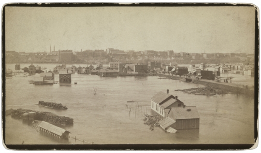
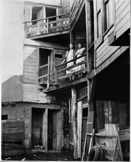
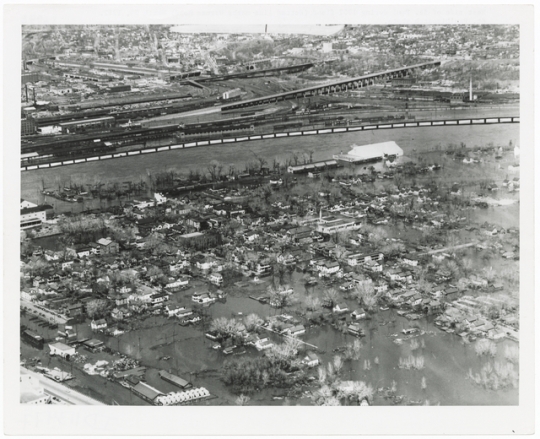
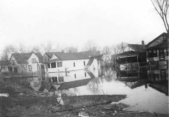
Almost all the housing in the Flats was modest at best. There was no point in building a nice house; the Mississippi flooded nearly every spring, and on the lowland there was no escape. As early as 1917 a St. Paul housing survey found that almost half the houses in the Flats had no sewer connection. A third had no bathing facilities. The one public school, Lafayette Elementary, was poorly built and overcrowded. The city dump was nearby, and there were no parks—just one playground. In all, it was “the worst kind of slum.”
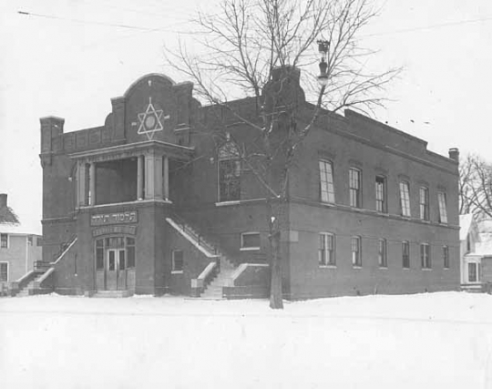
People lived there anyway. They built lives, livelihoods, and institutions. Irish Catholics worshipped at St. Michael's Church, which was built in 1866 and moved to a new location within the neighborhood in 1882. Two synagogues opened in 1889, and more followed, as did a cheder (a Jewish religious school). Neighborhood House, founded in 1900, was at first a Jewish settlement house but later opened to all.
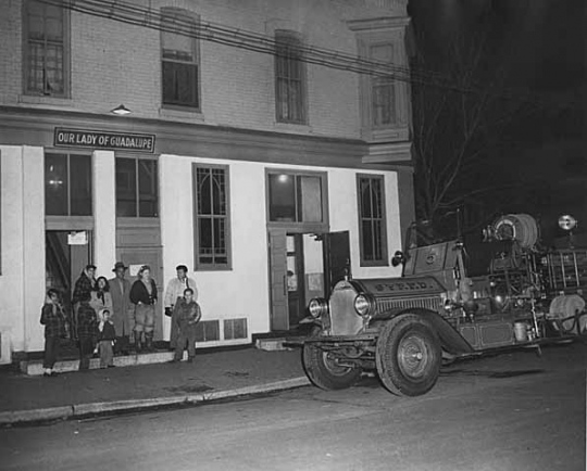
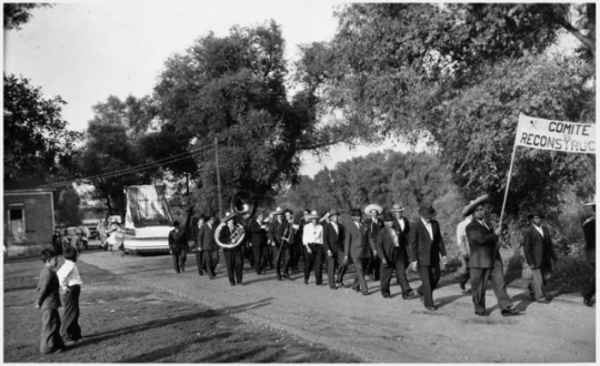
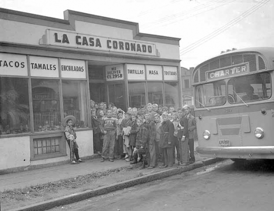
In the twentieth century non-Jews arrived in appreciable numbers, especially Christian Syrians and Mexican Americans. Their church, Our Lady of Guadalupe, opened in the heart of the Flats in 1931. By then, Jews made up only about a third of the population of the Flats.
The Depression ensured that housing on the Flats, most of it built in the nineteenth century, would get worse. A devastating 1952 flood proved that frame houses built on a floodplain were vulnerable. In 1956 the city’s Port Authority announced the creation of Riverview Industrial Park—a project that needed every acre of the Flats. The city began buying houses in 1961 and tearing them down in 1962. By the end of 1963 the last residents of the Flats had left.

Holmquist, June Drenning, ed. They Chose Minnesota: A Survey of the State’s Ethnic Groups. St. Paul: Minnesota Historical Society Press, 1981.
Kunz, Virginia Brainerd, ed. Discover St. Paul: A Short History of Seven St. Paul Neighborhoods. St. Paul: Ramsey County Historical Society, 1979.
Moran, Gerard. The James Hack Tuke Emigration Schemes from Connemara, 1882–1884. Galway County Heritage Office.
https://heritage.galwaycommunityheritage.org/content/topics/galway-emigration-and-diaspora-connections/tuke-emigration-scheme/the-james-hack-tuke-emigration-schemes-from-connemara-1882-4
Pierce, Lorraine E. “The Jews of St. Paul’s Lower West Side.” American Jewish Archives 28, no. 2 (November 1976): 149.
——— . "St. Paul’s Lower West Side." Master’s Thesis University of Minnesota, Minneapolis, 1971.
Rosenblum, Gene H. The Lost Jewish Community of the West Side Flats 1882–1962. Chicago: Arcadia Publishing Co., 2002.
 |
 |
 |
 |
 |
 |
 |
 |
 |
 |
 |
 |
 |
 |
 |
 |
 |
 |
 |
 |
 |
 |
In 1952 St. Paul’s worst flood on record covers the Flats and persuades the local government that no housing should be permitted in the floodplain.
The Treaty of Mendota transfers control of lands that include what will later become St. Paul’s West Side from the Dakota to the United States, thus opening it to legal Euro-American immigration.
St. Michael's Church opens on the West Side Flats to minister to the neighborhood's Irish Catholic population.
The city of St. Paul annexes 2800 acres on the West Side, the flats, and higher ground, with a southern boundary of what is now Annapolis Street. The Wabasha Bridge, originally a toll bridge, is rebuilt as a toll-free, public crossing.
Over the winter, the first Russian Jews, fleeing pogroms in Russia, arrive in St. Paul. Later that year about twenty of them settle on the West Side Flats. They are the first of thousands to immigrate from Russia, Poland, Lithuania, and Romania.
The Robert Street Bridge, a second bridge between downtown and the Flats, opens. A railroad bridge also connects the Flats with the railroad terminals downtown.
The first West Side synagogue is built.
The Flats’ population is 71.9% Jewish, with 463 Jewish families.
World War I labor needs bring the first Mexican American settlers to the West Side Flats.
The 447 Jewish families living in the Flats make up 36.6% of the neighborhood’s population.
Our Lady of Guadalupe Church opens.
A Neighborhood House report calls the Flats “the largest slum area in the Twin Cities.”
In the spring, the worst St. Paul flood in recorded history heavily damages the Flats.
The St. Paul Port Authority announces its plan to convert all of the Flats into an industrial park.
Buyouts begin. There are 480 buildings to be razed and 2147 people to be moved. In March Our Lady of Guadalupe Church opens a new building outside the Flats.
By December 298 buildings have been taken down. Two-thirds of residents have been relocated elsewhere on the West Side.
The Flats have been cleared; a flood wall is built.
Made possible by the Arts and Cultural Heritage Fund through the vote of Minnesotans on November 4, 2008. Administered by the Minnesota Historical Society.
Minnesota Historical Society • 345 W. Kellogg Blvd., St. Paul, MN 55102-1906 (Map) • 651-259-3000 © MNHS.
Send questions or comments to mnopedia![]() mnhs [dot] org. View our Privacy Policy.
mnhs [dot] org. View our Privacy Policy.