- Membership |
- Shop |
- Calendar |
- Donate
A resource for reliable information about significant people, places, events, and things in Minnesota history.
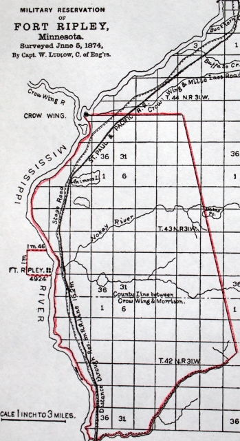
Map of Fort Ripley as surveyed in 1874, showing the ninety square miles of reservation land on the east side of the river and one square mile for the actual post on the west side. The sale of parcels on the east side in 1857, and subsequent annulment of the sale, created legal problems that took twenty years to untangle. (From 46 Congress, 2 session, Senate Reports, no. 196, serial 1893.)
Made possible by the Arts and Cultural Heritage Fund through the vote of Minnesotans on November 4, 2008. Administered by the Minnesota Historical Society.
Minnesota Historical Society • 345 W. Kellogg Blvd., St. Paul, MN 55102-1906 (Map) • 651-259-3000 © MNHS.
Send questions or comments to mnopedia![]() mnhs [dot] org. View our Privacy Policy.
mnhs [dot] org. View our Privacy Policy.