- Membership |
- Shop |
- Calendar |
- Donate
A resource for reliable information about significant people, places, events, and things in Minnesota history.
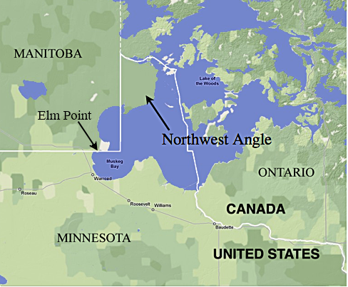
Map showing the size and location of the Northwest Angle relative to surrounding bodies of water and political divisions, including those demarcating Manitoba, Ontario, and Minnesota. Image by Wikimedia Commons user The Illusional Ministry, January 19, 2009. GNU free documentation license.
Made possible by the Arts and Cultural Heritage Fund through the vote of Minnesotans on November 4, 2008. Administered by the Minnesota Historical Society.
Minnesota Historical Society • 345 W. Kellogg Blvd., St. Paul, MN 55102-1906 (Map) • 651-259-3000 © MNHS.
Send questions or comments to mnopedia![]() mnhs [dot] org. View our Privacy Policy.
mnhs [dot] org. View our Privacy Policy.