A resource for reliable information about significant people, places, events, and things in Minnesota history.
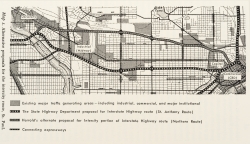
Map of the Interstate 94 corridor, 1965. From Alan A. Altshuler’s The City Planning Process: A Political Analysis (Ithaca, NY: Cornell University Press, 1965). Used with the permission of Cornell University Press.
In the 1950s, planned construction of Interstate Highway 94 (I-94) threatened to fracture four Twin Cities neighborhoods: Rondo, Prospect Park, Merriam Park, and Seward. Although each community responded differently and achieved different results, all were models of persistence and resistance.
In 1920, the St. Paul city engineer mapped the St. Anthony Avenue corridor, which cut into four neighborhoods, as a potential path for a road linking Minneapolis and St. Paul. By 1940, with civic organizations’ endorsements, the Minnesota Department of Highways (MDH) approved this route with a river crossing at Twenty-Sixth Street in Minneapolis. In 1956, Federal Interstate Highway Act funds enabled the MDH to acquire land and begin construction.
When construction began, Twin Cities newspapers provided freeway news to unaware local residents. Urban neighborhoods that pushed back faced powerful forces—especially MDH, which had a reputation for effective planning and timely building. In 1959 state legislation stripped localities of veto power over highway projects, a blow to neighborhoods. With construction already started, the four affected neighborhoods challenged officials to negotiate freeway changes.
The largest African American neighborhood in St. Paul was Rondo. Vibrant, racially integrated, and bounded by Rice Street, Lexington, University and Selby Avenues, it supported home ownership and local businesses. In 1953, neighbors learned their elementary school would fall to the freeway. Reverend Floyd Massey (representing Pilgrim Baptist Church) and Timothy Howard, spokesmen for the Rondo–St. Anthony Improvement Association, negotiated with city and state officials to block an elevated freeway section between Western and Lexington Avenues. Nevertheless, 600 Rondo families, many of them working class, lost their homes. Leaders tried to convince city officials to support a fair housing ordinance but failed. Lack of political clout, along with racial and class bias, left Rondo vulnerable.
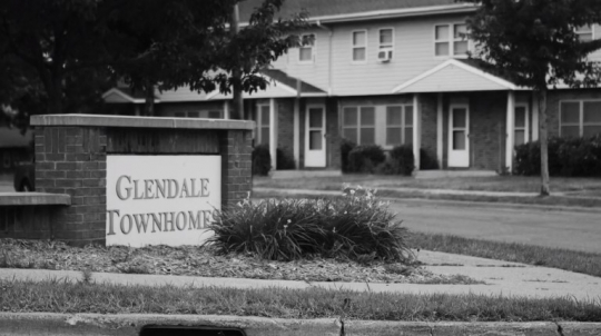
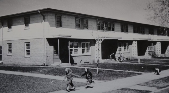
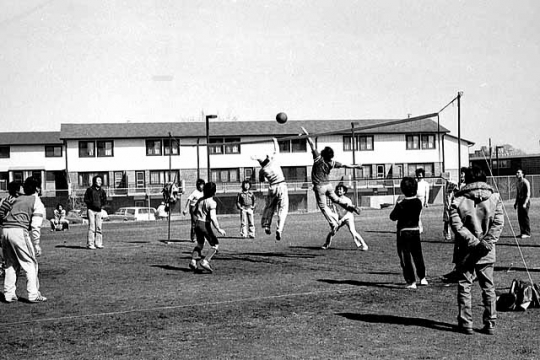
Five miles to the west, Prospect Park in Minneapolis was also in the freeway’s path. MDH plans threatened 100 Prospect Park homes, Glendale Housing project, and Luxton Park. Alerted in 1956, residents supported a freeway route with a crossing into Minneapolis at Twenty-Sixth Street. Leader Norma Olson, middle-class volunteers Ann Munt, Jere Purple, and their neighbors gained access to the governor. The Prospect Park–East River Road Association lobbied to divert the freeway to the railroad spur at Twenty-Sixth Street, but University Avenue and downtown Minneapolis businesses prevailed with the more direct MDH route through Prospect Park that crossed the river at Dartmouth Avenue. Some route adjustments saved the housing project and park, but the neighborhood was cut in two.
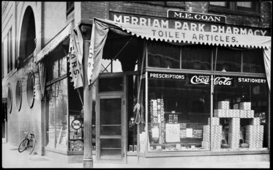
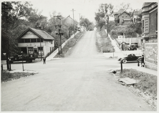
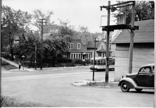
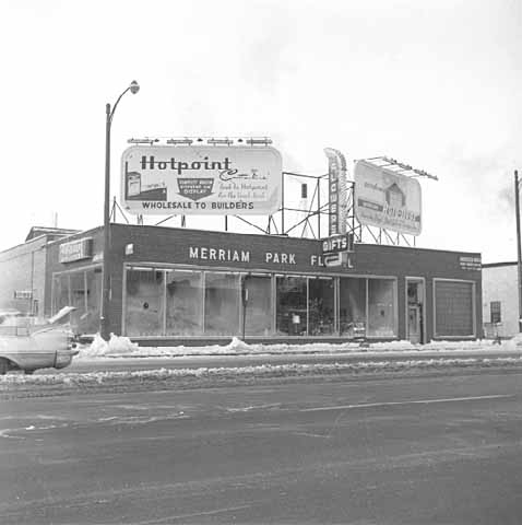
Between Rondo and Prospect Park lay Merriam Park. Professional, white, middle-class, and Catholic, residents had formed the Merriam Park Residential Association (MPRA) in 1959. Under the leadership of Monsignor Francis Gilligan and Doug Kelm, the MPRA mobilized a sustained and effective pressure campaign. With connections to the Archdiocese and elected officials, the MPRA challenged city, state, and federal highway bureaucrats with insider and outsider tactics, including direct action and lobbying, to block an elevated freeway between Snelling and Cleveland Avenues and contest exits at Prior and Cretin Avenues. Testifying with other community organizations at a hearing in 1960, the MPRA held back its support for the Twenty-Sixth Street river crossing, demanding its own freeway design changes be met first.
Seward in South Minneapolis lay across the river from Prospect Park. In 1959, the city proposed a comprehensive plan for Seward that led the Seward Elementary PTA to lobby for a new Seward school, neighborhood park, and school playground. The coming freeway cut off nearby Riverside Park to residents and students. Clergy, teachers, and residents challenged plans to build a large supermarket and take homes on Franklin Avenue. By 1965, the Seward Neighborhood Group (SNG), successor to the PTA, gained Matthews Park, a new playground and new Seward Elementary school. The SNG settled for senior housing and smaller businesses along Franklin Avenue, but 35 percent of neighborhood was cleared by renewal during the freeway fight.
The struggles of each of the four neighborhoods benefited others. In the coming decades, community organizations and coalitions stopped freeway expansions in St. Paul and Northeast Minneapolis. Environmental laws passed in 1969 gave new tools of resistance to residents. While Rondo suffered grievous losses, its struggle foreshadowed 1969 fair housing laws. Although Prospect Park’s lobbying fell short, it found allies for future freeway fights. Merriam Park’s creativity and engagement of powerful politicians and institutions were emulated, and Seward’s efforts highlighted community development and resources needed by an aging neighborhood.

“7 of 10 Minnesotans Back Boost in Gasoline Tax for U.S. Roads.” Minneapolis Tribune, November 8, 1959.
Cavanaugh, Patricia. Politics and Freeways: Building the Twin Cities Interstate System. Minneapolis: Center for Urban and Regional Affairs & The Center for Transportation Studies, University of Minnesota, 2006.
Epstein, Wendy, et al., eds. A People’s History of the Seward Neighborhood. Minneapolis: Nodin Press, 2018.
Federal Transit Administration. National Environmental Policy Act: What Is NEPA?
Originally found at: https://www.transit.dot.gov/regulations-and-guidance/environmental-programs/national-environmental-policy-act
Interstate 94: A History and Its Impact. Twin Cities PBS.
http://www.tpt.org/interstate-94-a-history-and-its-impact
Minnesota Statutes, Chap. 161.17, subd. 2.
McClure, Jane. “Rondo Neighborhood. ”St. Paul Historical. http://saintpaulhistorical.com/items/show/160
O’Connell, Tom, and Tom Beer. “Preserving a Fine Residential District: The Merriam Park Freeway Fight.” Ramsey County History 47, no. 4 (Winter 2013): 3–13.
https://publishing.rchs.com/wp-content/uploads/2015/11/RCHS_Winter2013_OConnellBeer.pdf
“Rondo Neighborhood & I-94: Overview.” Minnesota History Society, Gale Family Library, http://libguides.mnhs.org/rondo
 |
 |
 |
 |
 |
 |
 |
 |
 |
In 1947, St. Paul City Engineer George Harrold recommends moving the proposed route of I-94 to the north, saving parts of multiple neighborhoods from destruction. The Minnesota Department of Highways rejects his plan, saying a route along St. Anthony is more direct and better serves Midway-area businesses.
The St. Paul city engineer draws a plan for a radial highway system with a western route to Minneapolis along St. Anthony Avenue.
The Federal Bureau of Public Roads studies the feasibility of a national system of superhighways.
The National Interregional Highway Committee recommends building 34,000 miles of interstates, with another 5,000 for bypasses and urban routes.
The St. Paul City Council approves the Minnesota Department of Highways’ (MDH’s) plan for a Twin Cities freeway.
Rondo residents Timothy Howard and Reverend Floyd Massey Jr. form the Rondo–St. Anthony Improvement Association, which works to stop construction of an elevated freeway section between Western and Lexington Avenues.
MDH officials present freeway plans to enthusiastic local officials hosted by the Minneapolis Chamber of Commerce. Highway program far along and an expressway between downtowns is a top priority.
Construction of I-94 begins in September.
Throughout the fall and winter, Prospect Park residents lobby city and state officials to divert the proposed path of I-94 from their neighborhood to the railroad spur at Twenty-Sixth Street.
Seward PTA leaders organize to give input on how construction plans will affect their neighborhood.
The Merriam Park Residential Association forms. Over the next three years, it speaks out against a proposed elevated freeway between Snelling and Cleveland Avenues and exits at Prior and Cretin Avenues.
The urban section of I-94 opens.
Made possible by the Arts and Cultural Heritage Fund through the vote of Minnesotans on November 4, 2008. Administered by the Minnesota Historical Society.
Minnesota Historical Society • 345 W. Kellogg Blvd., St. Paul, MN 55102-1906 (Map) • 651-259-3000 © MNHS.
Send questions or comments to mnopedia![]() mnhs [dot] org. View our Privacy Policy.
mnhs [dot] org. View our Privacy Policy.