- Membership |
- Shop |
- Calendar |
- Donate
A resource for reliable information about significant people, places, events, and things in Minnesota history.
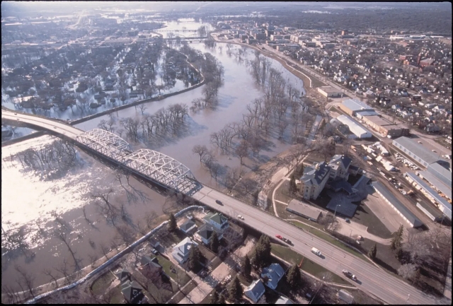
An aerial view of Grand Forks, East Grand Forks, and Sorlie Bridge over the flooded Red River, April 1, 1997. North Dakota is on the left side of the river and Minnesota on the right. Photo by Mike Rieger for the Federal Emergency Management Agency (FEMA). Public domain.
Made possible by the Arts and Cultural Heritage Fund through the vote of Minnesotans on November 4, 2008. Administered by the Minnesota Historical Society.
Minnesota Historical Society • 345 W. Kellogg Blvd., St. Paul, MN 55102-1906 (Map) • 651-259-3000 © MNHS.
Send questions or comments to mnopedia![]() mnhs [dot] org. View our Privacy Policy.
mnhs [dot] org. View our Privacy Policy.