- Membership |
- Shop |
- Calendar |
- Donate
A resource for reliable information about significant people, places, events, and things in Minnesota history.
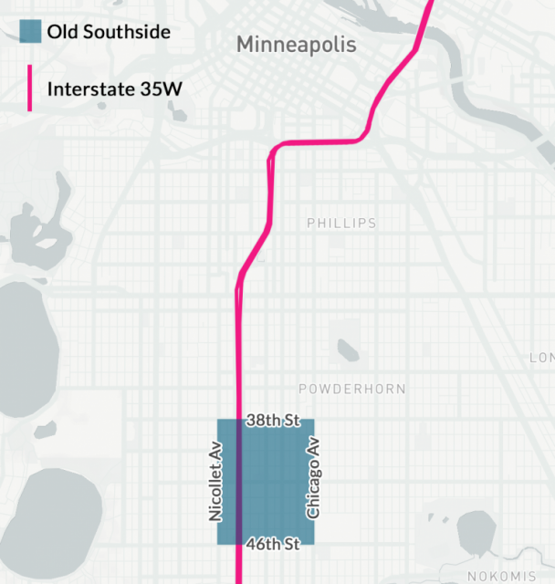
Map created by A Public History of 35W showing the boundaries of the Old Southside of Minneapolis as defined by Dr. Ernest Lloyd in “How Routing an Interstate Highway through South Minneapolis Disrupted an African-American Neighborhood,” PhD dissertation, Hamline University, 2013.