- Membership |
- Shop |
- Calendar |
- Donate
A resource for reliable information about significant people, places, events, and things in Minnesota history.
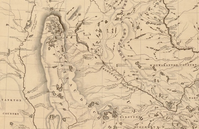
Detail of a map of the "Hydrographical basin of the upper Mississippi River from astronomical and barometrical observations, surveys, and information," created in 1843 by Joseph N. Nicollet for the US War Department. The drafters of the Treaty of Traverse des Sioux (1851) used the map to delineate land cessions, and to claim land from the Sisseton Dakota around Pipestone Quarry that was actually the territory of the Yankton Dakota. The Yankton did not cede said territory until the ratification of an 1858 treaty signed in Washington, DC.
Made possible by the Arts and Cultural Heritage Fund through the vote of Minnesotans on November 4, 2008. Administered by the Minnesota Historical Society.
Minnesota Historical Society • 345 W. Kellogg Blvd., St. Paul, MN 55102-1906 (Map) • 651-259-3000 © MNHS.
Send questions or comments to mnopedia![]() mnhs [dot] org. View our Privacy Policy.
mnhs [dot] org. View our Privacy Policy.