- Membership |
- Shop |
- Calendar |
- Donate
A resource for reliable information about significant people, places, events, and things in Minnesota history.
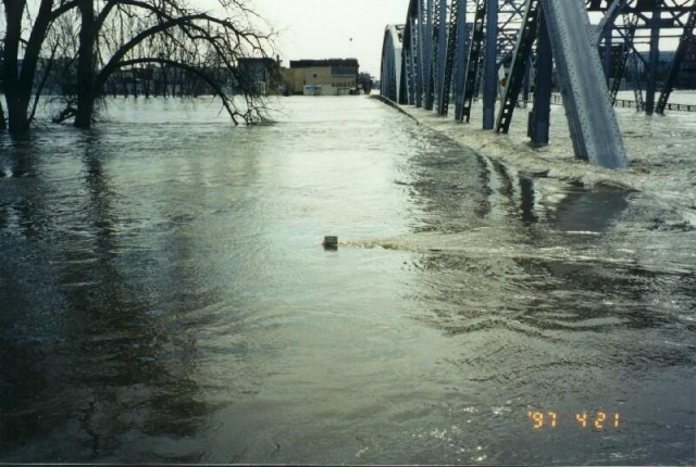
The top of a US Geological Survey staff gauge (a graduated rod against which water levels can be read) is barely visible above the water flooding Sorlie Bridge on April 21, 1997. The top of the gauge represents a water level or river stage of 54.50 feet, two feet above the 1997 East Grand Forks city levee. During the 1997 flood, the Red River crested at 54.35 feet; the National Weather Service flood stage at Grand Forks is 28.00 feet. Photo by the United States Geological Survey.
Made possible by the Arts and Cultural Heritage Fund through the vote of Minnesotans on November 4, 2008. Administered by the Minnesota Historical Society.
Minnesota Historical Society • 345 W. Kellogg Blvd., St. Paul, MN 55102-1906 (Map) • 651-259-3000 © MNHS.
Send questions or comments to mnopedia![]() mnhs [dot] org. View our Privacy Policy.
mnhs [dot] org. View our Privacy Policy.