- Membership |
- Shop |
- Calendar |
- Donate
A resource for reliable information about significant people, places, events, and things in Minnesota history.
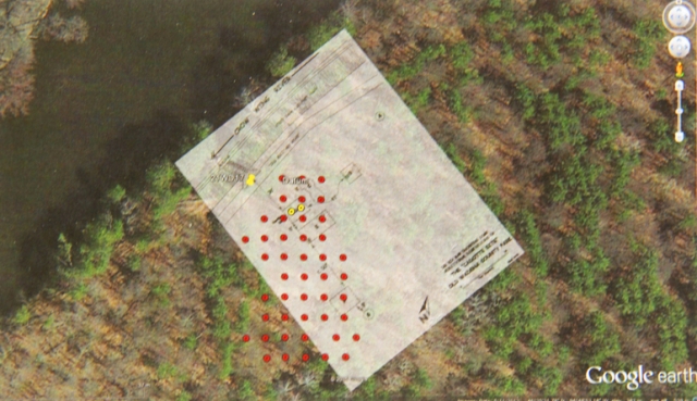
Google map of the Cadotte Post site with overlay of Douglas Birk’s 1972 sketch and an approximation of the location of the survey grid. From, Hayes, Katherine. Results of Survey and Excavation of the Little Round Hill (2WD16) and Cadotte Post (21WD17) Sites in Wadena County, Minnesota: A View of the Fur Trade in the Late Eighteenth Century. Report prepared for the Wadena County Historical Society, 2014.