- Membership |
- Shop |
- Calendar |
- Donate
A resource for reliable information about significant people, places, events, and things in Minnesota history.
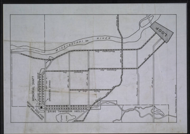
1921 map showing the location of Victory Memorial Parkway relative to the North Loop of Minneapolis. The dashed lines indicate streetcars lines that many of the over 30,000 dedication ceremony attendees could have used to get to what was then the edge of development in Minneapolis. Also shown are the location of the ceremony’s grandstand and speaker’s stand at the northwest corner of the parkway at the site of the memorial flagpole base.
Made possible by the Arts and Cultural Heritage Fund through the vote of Minnesotans on November 4, 2008. Administered by the Minnesota Historical Society.
Minnesota Historical Society • 345 W. Kellogg Blvd., St. Paul, MN 55102-1906 (Map) • 651-259-3000 © MNHS.
Send questions or comments to mnopedia![]() mnhs [dot] org. View our Privacy Policy.
mnhs [dot] org. View our Privacy Policy.