- Membership |
- Shop |
- Calendar |
- Donate
A resource for reliable information about significant people, places, events, and things in Minnesota history.
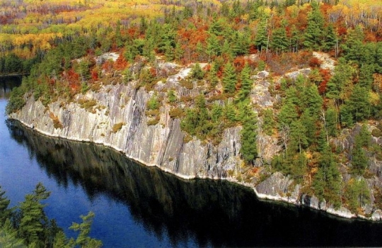
Overhead view of Voyageurs National Park. National Park Service, undated. Public domain.
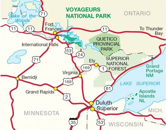
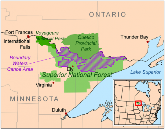
Voyageurs National Park is located on the Minnesota–Ontario international border and is Minnesota’s only national park. Established in 1975, it is a 341-square-mile network of lakes and streams surrounding the Kabetogama Peninsula. Though the region has been home to various Indigenous nations for countless generations, the park is named for the predominantly French Canadian voyageurs (travelers) who transported furs and other trade goods between hubs like Montreal and points further west.
The overall topography of Voyageurs was formed most recently by the last glaciation period, which ended around 10,000 years ago. As glaciers scoured the earth, they melted, eroded the land, and filled the region with water.
Water is a major feature of the present-day park, 40 percent of which is made up of lakes; 70 percent of the remaining land mass is boreal forest. The four largest lakes are Rainy Lake (Gojiji-zaaga'igan), Kabetogama Lake (Gaa-biitoogamaag-zaaga'igan), Namakan Lake, and Sand Point Lake, all of which are part of the Arctic watershed of Hudson Bay. Wolves, moose, beavers, and other iconic Upper Midwestern animals live in the park.
When French fur trader Jacques de Noyon and his party canoed into the region in 1688, seeking to learn about the area’s resources, Cree, Monsoni, and Ojibwe people were already living there. It became a part of a major route over which voyageurs moved animal furs to Montreal and trade goods to the Canadian northwest territory.
By the 1760s, the Bois Forte Ojibwe had become the primary Indigenous group in the Voyageurs National Park region. For another century, Ojibwe families lived in the area, trading furs for manufactured goods that they integrated into traditional lifeways. But after Minnesota became a state in 1858, American entrepreneurs wanted to exploit the area’s timber and mineral resources.
In 1866, the Bois Forte Ojibwe signed a treaty that transferred two million acres of their homeland (between present-day Lake Vermillion and the Canadian border) to the United States. They continued, however, to live on and harvest the natural resources of their original territory.
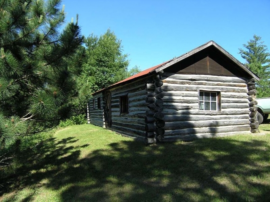
In the 1870s, homesteaders began to move into the region, with land surveys occurring between 1880 and 1901. In the 1890s, the immigrants were carrying out logging, commercial fishing, and agriculture and welcoming tourists. There was also a short-lived gold rush on Little American Island in Rainy Lake.
Lumber barons, most notably Edward Wellington Backus, had a profound impact on the forest composition and water levels of the region. Logging of valuable white and red pine essentially deforested some areas, except for the pines on the shoreline. Likewise, Backus constructed a dam at International Falls in 1910 and two more dams at Kettle Falls and Squirrel Falls in 1914. These dams powered sawmills and paper mills in the region, and as of 2020, they still control the water levels of the park.
In 1962 Governor Elmer Andersen traveled to the Kabetogama Peninsula with staff of the National Park Service (NPS) and other Minnesota officials, and the subsequent report of that trip was the first public indication of state and federal interest in creating Voyageurs National Park. A proposal for the park was written in 1963 and revised in 1964 to exclude the lands between Namakan Lake and Crane Lake due to pressure from the US Forest Service.
The proposed park was a divisive subject. Local residents were opposed to its creation because they saw it as encroachment by the federal government that would limit logging and hunting in the area and decrease taxable property.
Ultimately, legislation authorizing the establishment of the park was passed by the US Congress in December of 1970 and signed by President Richard Nixon in 1971. State and local governments donated land holdings to the park, allowing its formal establishment in 1975. Private lands in the park were purchased as well, but this was and remains a contentious issue, since many landowners felt pressure to sell. As of 2020, over 900 acres of land within the boundaries remain privately owned.
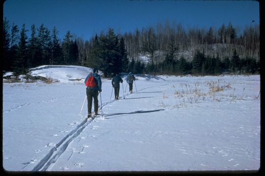
After the establishment of the park, the NPS began planning and constructing trails, boating sites, and other amenities. The park has also been used for scientific research and conservation. In 1992, a wildlife protection zone was established for the gray wolf. Over 220 Indigenous pre-contact sites have been identified within the park, some of which are listed on the National Register of Historic Places.

Koochiching County Government. “The Homesteaders.”
https://www.co.koochiching.mn.us/218/The-Homesteaders
Midwest Region National Park Service. Proposed Voyageurs National Park, Minnesota. Omaha, NE: US Department of the Interior, National Park Service, July 1964.
http://www.npshistory.com/publications/voya/proposed/index.htm
National Park Service. “Fiscal Year 2017 Accomplishments and Statistics.”
https://www.nps.gov/voya/learn/management/upload/FINAL-FY17-Accomplishments.pdf
——— . “Nature & Science.”
https://www.nps.gov/voya/learn/nature/index.htm
——— . “Native American.”
https://www.nps.gov/voya/learn/historyculture/nativeamerican.htm
——— . “Ojibwe Indian.”
https://www.nps.gov/mwac/voya/shapingvoya/OjibweIndian.html
——— . “Voyageurs: National Park Minnesota.”
https://www.nps.gov/voya/index.htm
Repanshek, Kurt. “National Park Service Suspending Fee Collections Across the Park System.” National Parks Traveler, March 18, 2020.
https://www.nationalparkstraveler.org/2020/03/update-3-national-park-service-suspending-fee-collections-across-park-system
“The Voyageurs.” McGill University, 2000.
https://digital.library.mcgill.ca/nwc/history/08.htm
Witzig, Frederick Theodore. Eighty Years in the Making: A Legislative History of Voyageurs National Park. [Washington, DC]: National Park Service, 2000. https://archive.org/details/eightyyearsinmak00witz/page/n1/mode/2up
——— . Voyageurs National Park: The Battle to Create Minnesota’s National Park. Minneapolis: University of Minnesota Press, 2004.
Zenzen, Joan M. Building a Park for All: A History of Voyageurs National Park, Minnesota. US Department of the Interior, National Park Service: 2017.
http://npshistory.com/publications/voya/adhi.pdf
 |
 |
 |
 |
 |
 |
 |
 |
 |
 |
 |
 |
In 1975, Voyageurs National Park is formally established as the United States’ thirty-sixth national park.
Cree, Monsoni, and Ojibwe people are the primary inhabitants of the region.
Jacques de Noyon canoes through the area.
Propelled by the wealth of the fur trade, voyageurs frequent the area as a part of their trade route to the French Canadian territories to the north and west.
The Ojibwe become the dominant Indigenous group in the region.
On April 7, the US signs a treaty with the Bois Forte Chippewa (Ojibwe) that acquires their land in north central Minnesota. It pays them 4 cents an acre. The Ojibwe ignore the treaty and continue to live their traditional life in their homeland.
Homesteaders and squatters begin to move into the region.
Gold is found in the Rainy Lake region, which sparks a short-lived gold rush.
Logging and fishing in Northeast Minnesota become commercial, large-scale industries.
An estimated 130 Bois Forte Ojibwe are still living in forty-five houses within the Voyageurs National Park area.
Joe Whiteman is likely the last Ojibwe person to live in what would become the park. Whiteman lived in the Moose River area until he died in 1941.
On January 8, President Richard Nixon signs legislation authorizing the establishment of Voyageurs National Park.
A lawsuit contesting donation of school trust lands is resolved upon appeal.
32,000 local and state lands are officially deeded to the federal government for the creation of the national park.
Voyageurs National Park is established. Construction begins on trails and other park amenities.
The first wildlife protection zone is established within the park to minimize harm to the gray wolf.
Rainy Lake Visitor Center and park headquarters close due to the coronavirus pandemic while the park itself remains open.
Made possible by the Arts and Cultural Heritage Fund through the vote of Minnesotans on November 4, 2008. Administered by the Minnesota Historical Society.
Minnesota Historical Society • 345 W. Kellogg Blvd., St. Paul, MN 55102-1906 (Map) • 651-259-3000 © MNHS.
Send questions or comments to mnopedia![]() mnhs [dot] org. View our Privacy Policy.
mnhs [dot] org. View our Privacy Policy.