A resource for reliable information about significant people, places, events, and things in Minnesota history.
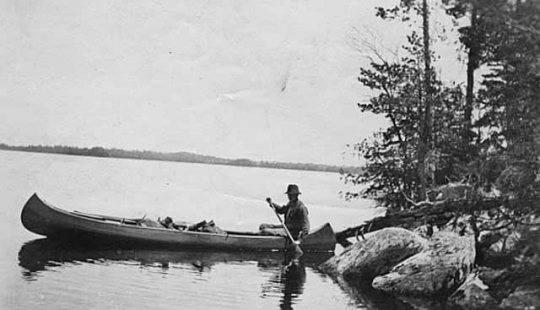
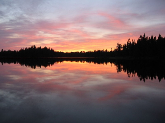
Iron Lake, Boundary Waters Canoe Area Wilderness, 2012.
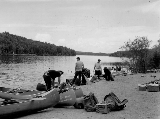
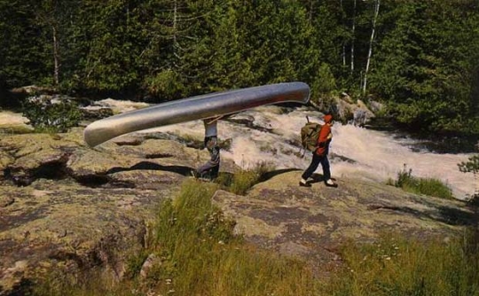
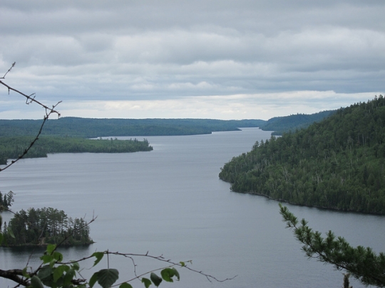
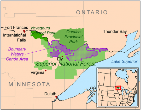
The Boundary Waters Canoe Area Wilderness is located in the northern third of Superior National Forest. It is the most heavily used wilderness in the country, with about 250,000 visitors annually.
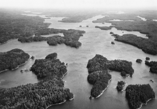
The Boundary Waters Canoe Area Wilderness (BWCAW) has over 1,200 miles of canoe routes, over 1,000 lakes, twelve hiking trails, and more than 2,000 designated campsites. It also contains one of the largest contiguous areas of uncut forest left in the United States. Eagle Mountain, the highest point in Minnesota, at 2,301 feet, is within the BWCAW.
Between 2.5 million and 10,000 years ago, glaciers from the last ice age shaped the lakes and rivers that the BWCAW became known for. Lakes and streams cover about 190,000 acres of its over-one-million-acre surface area.
Before European exploration and immigration, Dakota, Ojibwe, and other Indigenous people lived on the lands that now make up the BWCAW. They lived off the large variety of plants, fish, and animals in this area, using canoes to navigate the vast network of lakes and streams. Around the seventeenth century, European explorers reached present-day northern Minnesota, followed by fur traders and French Canadian voyageurs. These groups also heavily utilized canoes in their travels.
In 1902, the U.S. General Land Office set aside 500,000 acres of public lands as a forest reserve in northern Minnesota. In 1905, another 141,000 acres were set aside. Together, these lands became the Superior National Forest, dedicated by President Theodore Roosevelt in 1909.
In 1926, the U.S. secretary of agriculture designated three roadless areas in the Superior National Forest. Four years later, Congress passed the Shipstead-Newton-Nolan Act, which prohibited the building of dams that would change the water levels of the border lakes region. It also banned logging within 400 feet of all shorelines.
In 1934, President Franklin D. Roosevelt created the Quetico–Superior Committee to help the government protect and conserve the wilderness area. By 1936, due to boundary changes and new purchases, the federal government owned over two million acres of the Superior National Forest area.
In 1938, the U.S. Forest Service (USFS) established the Superior Roadless Primitive Area. In 1948, the USFS also established a no-cut zone along the border. The same year, Congress passed the Thy–Blatnik Act, which allowed the government to purchase private holdings within the wilderness. In 1949, President Truman issued an executive order to designate an air-space reservation over the area. Inside the reservation, planes were barred from flying below 4,000 feet over the wilderness.
The USFS changed the name of the Superior Roadless Primitive Area to the Boundary Waters Canoe Area in 1958. The National Wilderness Act was passed in 1964, and the BWCA became part of the National Wilderness Preservation System. A clause in the act allowed some logging and motor use within the wilderness to continue. In 1978, Congress enacted the BWCA Wilderness Act. The new legislation ended logging and snowmobiling, restricted mining, and allowed motorboat use on one fourth of the water area in the wilderness.
In 1999, about 300,000 acres of the wilderness were damaged by a large blowdown of timber. Millions of trees blew down in the eighty to 100 mile-per-hour winds.
In the early 2000s, PolyMet Mining Corp. and TwinMetals proposed open-pit and copper mines near the Boundary Waters wilderness. In 2013, an effort began to instate a federal ban on mining in the BWCA watershed. Out of this, a campaign called “Save the Boundary Waters” was created to work to protect the area from pollution caused by mining.
In the twentieth and twenty-first centuries, the BWCA faced controversy over conflicting ideas about how to use the wilderness. Since the early 1900s, it has been a popular fishing area. Many laws and acts of Congress prohibited the use of motorboats and airplanes, which provided easier access for recreational fishermen. Tourist resorts were also removed from the land within the wilderness after the Thy–Blatnik Act was passed.
Many cities near the wilderness fought to bring the mining and logging industries back to the area. The Izaak Walton League and figures like Sigurd Olson were the primary preservation activists for the BWCA between the mid-nineteenth and twenty-first centuries.

Atwood, Burton H. Controversy in the Boundary Waters Canoe Area: A Study. Glenview, IL: Izaak Walton League of America Endowment, 1964.
Backes, David. A Wilderness Within: The Life of Sigurd Olson. Minneapolis: University of Minnesota Press, 1997.
——— . Canoe Country: An Embattled Wilderness. Minocqua, WI: NorthWord Press, 1991.
Chadwick, Phil,et. al.. “The Boundary Waters-Canadian Derecho.” Storm Prediction Center: NOAA/National Weather Service.
http://www.spc.noaa.gov/misc/AbtDerechos/casepages/jul4-51999page.htm
Gladden, James N. The Boundary Waters Canoe Area: Wilderness Values and Motorized Recreation. Ames, IA: Iowa State University Press, 1990.
Helland, John. “Chronology of Historical Actions for Boundary Waters Canoe Area Wilderness within Minnesota’s Superior National Forest.” Minnesota House of Representatives Information Brief, October 2004.
http://www.house.leg.state.mn.us/hrd/pubs/bwcawild.pdf
Hemphill, Stephanie. “Ten Years After Blowdown, Boundary Waters Still Recovering.” MPR News, July 2, 2009.
https://www.mprnews.org/story/2009/07/01/bwca_blowdown_anniversary
History of the Boundary Waters Canoe Area Wilderness. Zenith City History Archives.
http://zenithcity.com/archive/north-south-shore/north-shore-ghost-towns/2/
Marcotty, Josephine. “Loved and Loathed, Longtime Activist Has Drawn a Line in BWCA.” Minneapolis Star Tribune, November 27, 2016.
http://www.startribune.com/bwca-girl-guide-is-now-a-woman-warrior/403115576/
Parke, Peter S., and Norvan J. Larson. “Boundary Waters Windstorm: The Blowdown of July 4th, 1999.” National Weather Service, undated.
http://www.weather.gov/media/dlh/StormSummaries/Other/19990704/parkelarsonwriteup.pdf
Save the Boundary Waters. About the Campaign.
https://www.savetheboundarywaters.org/about-campaign
United States Department of Agriculture: Forest Service. Boundary Waters Canoe Area Wilderness.
http://www.fs.usda.gov/detail/superior/specialplaces/?cid=stelprdb5202169
United States Department of Agriculture: Forest Service. BWCAW Act.
http://www.fs.usda.gov/detail/superior/specialplaces/?cid=stelprdb5203434
United States Department of Agriculture: Forest Service. Heritage History.
http://www.fs.usda.gov/detail/superior/learning/history-culture/?cid=fsm91_049843
Wilbers, Stephen. A Boundary Waters History: Canoeing Across Time. Charleston, SC: History Press, 2011.
 |
 |
 |
 |
 |
 |
 |
 |
 |
 |
 |
 |
In 1964, the Boundary Waters Canoe Area becomes part of the National Wilderness Preservation System.
The U.S. General Land Office sets aside 500,000 acres of public lands as a forest reserve in northern Minnesota.
An additional 141,000 acres is set aside in the forest reserve.
The land is dedicated as the Superior National Forest by President Theodore Roosevelt.
Congress passes the Shipstead-Newton-Nolan Act, which regulates logging and dams.
Quetico-Superior Committee is created to further conservation efforts.
The U.S. Forest Service (USFS) establishes the Superior Roadless Primitive Area.
Congress passes the Thy–Blatnik Act, and the USFS establishes a no-cut zone.
Air-space reservation is enacted by President Truman.
The Superior Roadless Primitive Area’s name is changed to the Boundary Waters Canoe Area.
The National Wilderness Act passes, and the BWCA becomes part of the National Wilderness Preservation System.
Congress enacts the BWCA Wilderness Act, which increases limitations on logging, snowmobiling, motor use, and mining.
The “Save the Boundary Waters Campaign” begins as part of an effort to instate a federal mining ban.
Growing wildfires lead the US Forest Service to close the BWCAW for the first time in forty-five years
Made possible by the Arts and Cultural Heritage Fund through the vote of Minnesotans on November 4, 2008. Administered by the Minnesota Historical Society.
Minnesota Historical Society • 345 W. Kellogg Blvd., St. Paul, MN 55102-1906 (Map) • 651-259-3000 © MNHS.
Send questions or comments to mnopedia![]() mnhs [dot] org. View our Privacy Policy.
mnhs [dot] org. View our Privacy Policy.